From Gargellen to the Heimspitze

Difficult
Mountaineering · Hiking · Gargellen
07:15 h duration
16,4 km Length in km
2683 m Highest point
1406 m Lowest point
1276 m gain Ascent
1276 m gain Descent
Difficulty

Tour description

A challenging summit hike from the center of Gargellen through the tranquil Vergalda Valley to the 2,685-meter-high Heimspitze, offering sweeping views of the Silvretta, Rätikon, and Verwall ranges.

The long trail to one of the most scenic peaks around the village begins right in Gargellen. You’ll hike through the Vergaldner Wäldle and the quiet Vergaldatal valley to the Vergaldaalpe, before the trail climbs steeply across alpine slopes, boulder fields, and the Schafberg up to the Heimspitze. At 2,685 meters, an impressive panoramic view of the Silvretta, Rätikon, and Verwall ranges opens up before you.

Starting Point - Directions - End Point

Starting Point
Gargellen town center

Directions
From the center of Gargellen, head first toward the Schafbergbahn and continue on to the Vergalda district. There, cross the Vergaldabach stream and you’ll reach a wider farm road. This road leads you into the peaceful Vergalda Valley. The valley gradually narrows, and the forested slopes gradually give way to open alpine meadows.
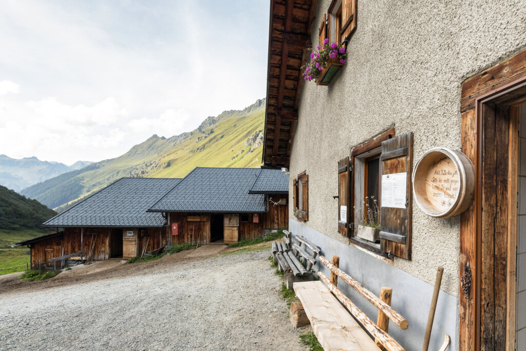
After climbing about 400 meters in elevation, you’ll reach the Vergaldaalpe at 1,820 meters. It’s the last alpine pasture in the Gargellen Valley and is a great spot to take a break before or after the summit climb.
Shortly past the alp, you’ll leave the wider trail. The mountain path now climbs much more steeply in numerous switchbacks across grassy slopes and dwarf shrubland. As you gain altitude, the view opens up back toward the Vergalda Valley and the opposite peaks of the Rätikon.
You’ll reach the Schafberg plateau and pass a small shepherd’s hut. After that, the terrain becomes increasingly alpine. The trail continues over steeper sections and, in places, through boulder fields toward the Heimspitze.
At a fork in the trail, head toward Heimspitze. After another ascent, you’ll reach a saddle from which the summit comes clearly into view for the first time. Below lies a small mountain lake, while the Zwischenspitze rises to the left.
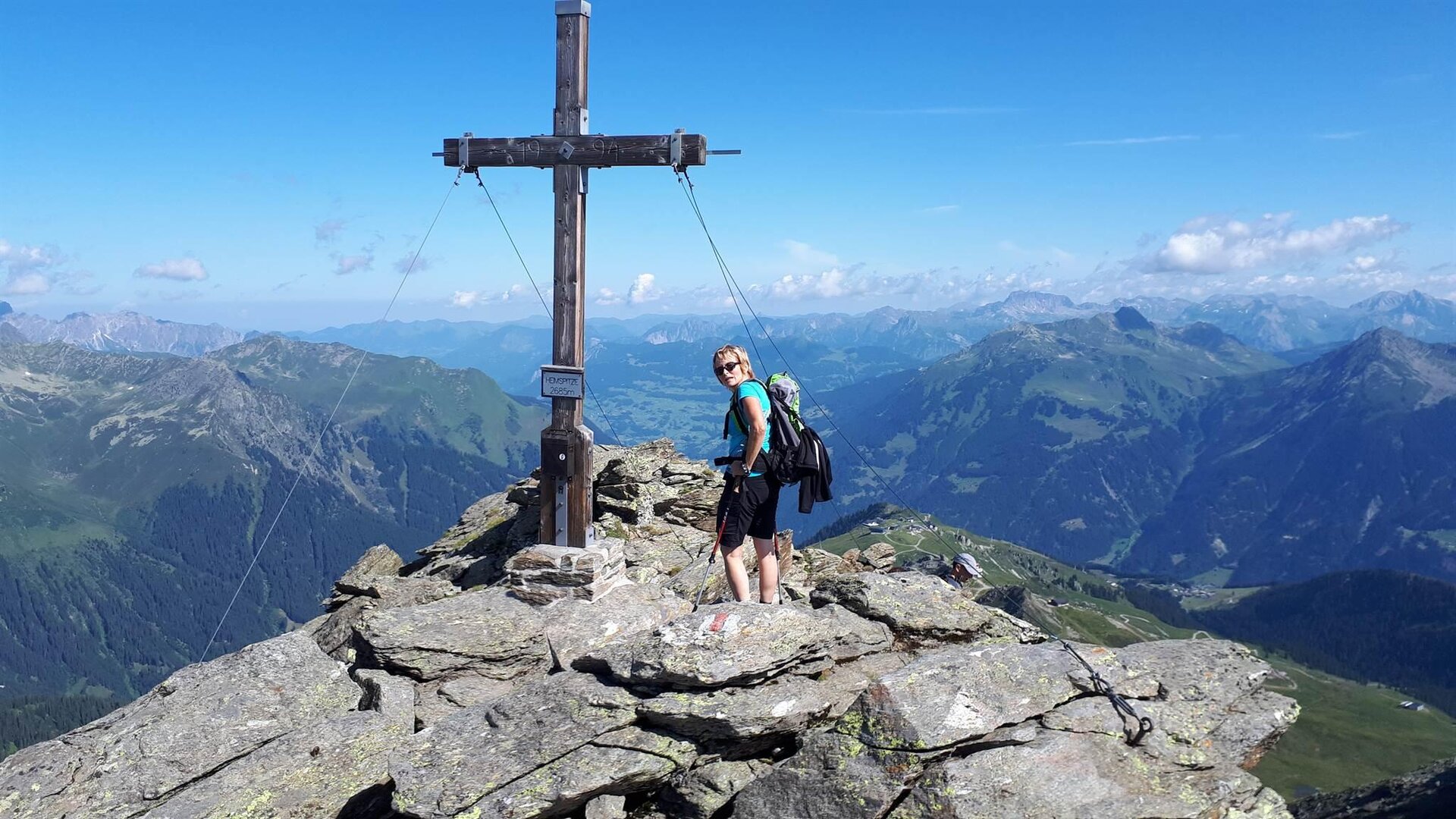
The marked trail initially follows the ridge and then crosses over to the southern flank of the Heimspitze. You continue ascending over steep grassy and rocky terrain. In the upper section, the terrain flattens out somewhat, and you’ll reach the summit cross of the Heimspitze at 2,685 meters via a boulder-strewn ridge.
From the summit, the view stretches far across the Silvretta with its striking peaks and glaciers, all the way to the Rätikon and the mountains of the Verwall.
The descent follows the same route. You’ll head back down the Schafberg to the Vergaldaalpe and then hike through the Vergaldatal valley and the Vergaldner Wäldle forest back to the center of Gargellen.

End Point
Gargellen town center

Getting to the starting point

By public transportation:
With the Montafon regional bus and the Montafonerbahn, you can get around the valley comfortably and flexibly. The train and bus connect the towns regularly, every half hour or every hour depending on the route. You can find your ideal connection HERE. The Gargellen Zentrum stop is a good starting point.

By car:
Take the A14 to the Bludenz/Montafon exit, then follow the Montafonerstraße L188 into the valley. In St. Gallenkirch, turn onto the Gargellnerstraße L192 and follow it to Gargellen.

Parking is available at the Gargellen Mountain Railways. From there, it’s just a few minutes’ walk to the starting point.

Important Information

The hike to the Heimspitze is a long and challenging day on the mountain. With more than 1,200 meters of elevation gain and loss, this hike requires excellent physical fitness.

In the upper section, you’ll be hiking on alpine trails. Sure-footedness, mountaineering experience, and good, ankle-high hiking boots are required. Some sections lead over steep grassy and rocky terrain as well as through boulder fields.

The steeper sections can be slippery, especially after prolonged rainfall. In early summer, old snowfields may still persist in shaded areas.

Check the current weather and trail conditions before setting out. If there’s a risk of thunderstorms, poor visibility, or unstable weather conditions, you should not attempt the summit climb.

Due to the length of the hike, you should bring plenty of drinks and food and allow for extra time.

Tips

Start early: With more than 1,200 meters of elevation gain and about seven hours of hiking, the Heimspitze makes for a full day in the mountains. Setting out early ensures you have plenty of time to spare.

Experience the Vergaldaalpe to the Full: The trail to the summit leads through one of the quieter side valleys of Gargellen. Take your time as you transition from the forested valley floor to the open alpine landscape.

Stop for a break at the Vergaldaalpe: This mountain hut is located right on the route and is an ideal spot for a break, especially on the descent. Be sure to try regional specialties there, such as Montafon Sura Kees.

Don’t turn back right away at the summit: The Heimspitze is one of the hiking peaks around Gargellen that offers particularly spectacular views. On a clear day, the view stretches from the peaks of the Rätikon over the Silvretta and far into the Verwall.

Sicherheitstipps für Wandern in Vorarlberg

EN NOTRUF:

EN 140 - Alpine Notfälle österreichweit 

EN 144 - Alpine Notfälle Vorarlberg 

EN 112 - Euro-Notruf (funktioniert mit jedem Handy/Netz) 

Properties
Route type Mountaineering, Hiking
Difficulty Difficult
Start Tourism information Gargellen
Finish Tourism information Gargellen
Elevation profile
Best months
Jan
Feb
Mar
Apr
May
Jun
Jul
Aug
Sep
Oct
Nov
Dec