Via ferrata Drusenfluh

Moderate
open
· Tschagguns
05:30 h duration
8,11 km Length in km
2825 m Highest point
1738 m Lowest point
1092 m gain Ascent
1092 m gain Descent
Stamina
Skill
Difficulty
Adventure
Scenery

Tour description

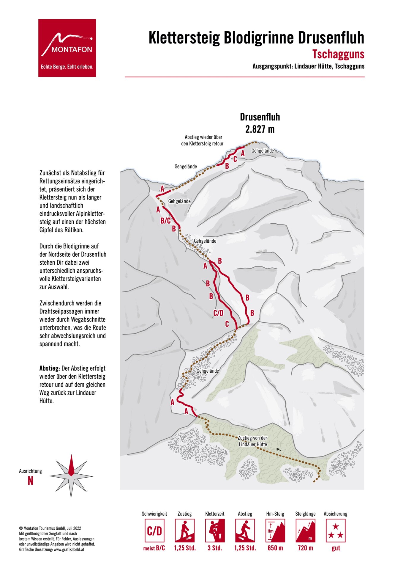
A long and scenically stunning alpine via ferrata through the Blodigrinne to one of the highest peaks in the Rätikon. Steep climbing sections, alpine trail segments, and two variants of varying difficulty make this tour particularly varied.

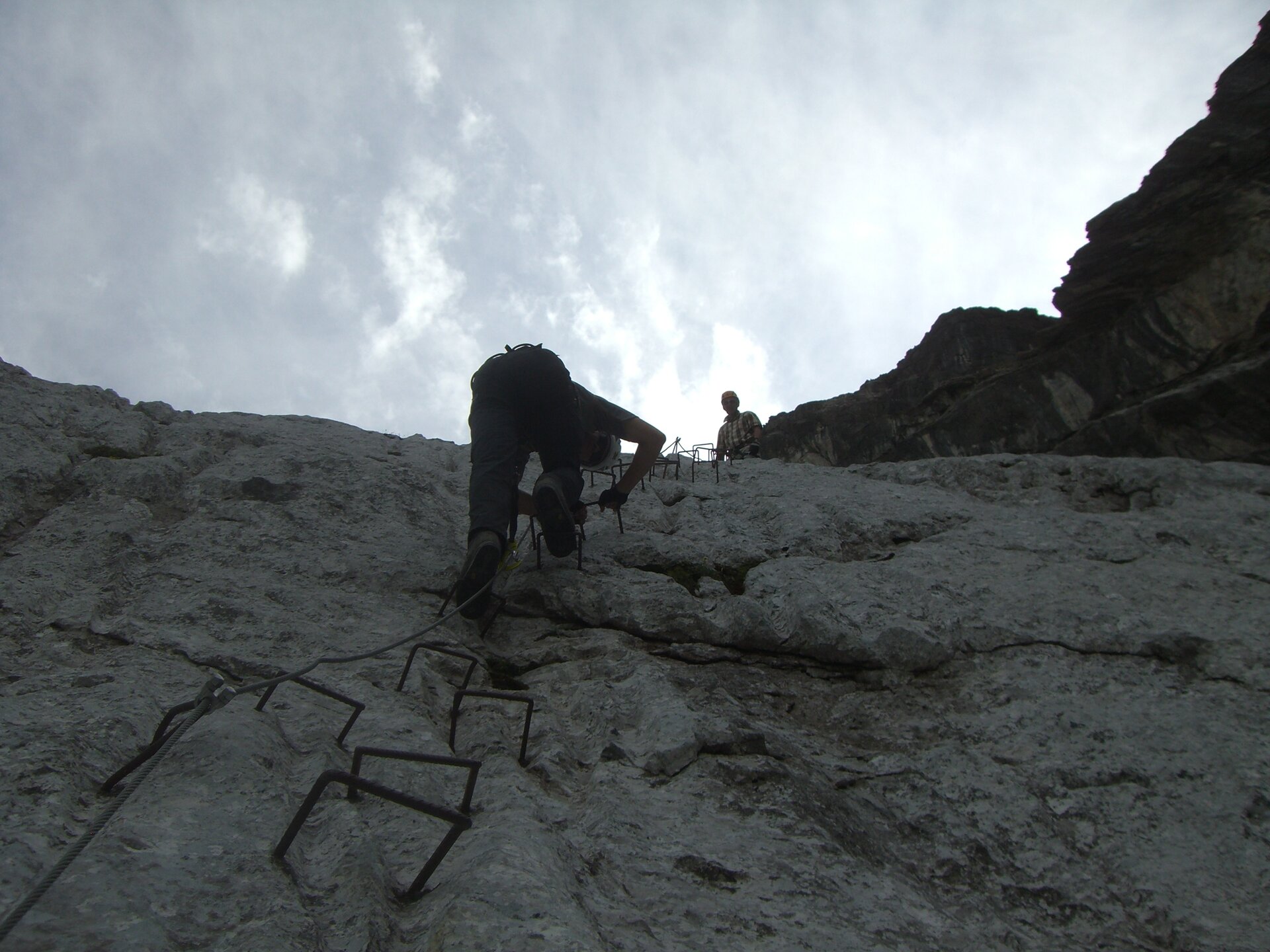
The Drusenfluh via ferrata leads through a striking gorge on the north face of the mountain. In the lower section, steep passages in the rugged Rätikon limestone await you, before the route continues from the Blodigsattel along an alpine trail to the summit.

A more challenging approach route reaches difficulty level D. Just below the summit, you’ll also need to climb about 40 meters at difficulty level II without steel cable protection. Alpine experience, sure-footedness, and excellent physical conditioning are therefore essential.

Start - Directions - Descent

Approach

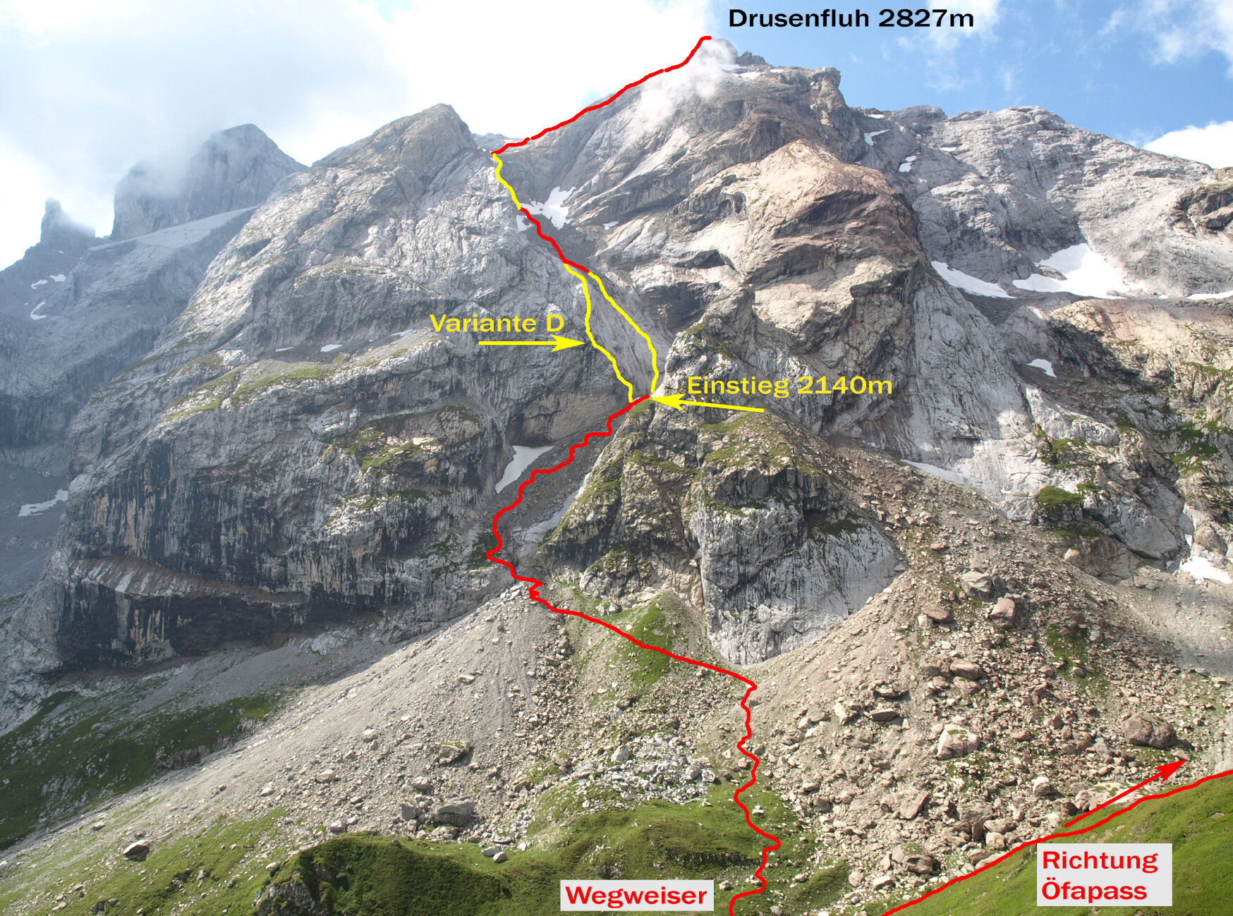
From the Lindauer Hütte, follow the hiking trail toward the Öfapass. At an elevation of about 2,080 meters, the marked trail branches off to the left at a signpost. This trail leads directly to the trailhead at the foot of the impressive gorge.

Route Description

In the lower section of the via ferrata, you have a choice of two routes with different levels of difficulty. The more challenging starting route reaches difficulty level D.

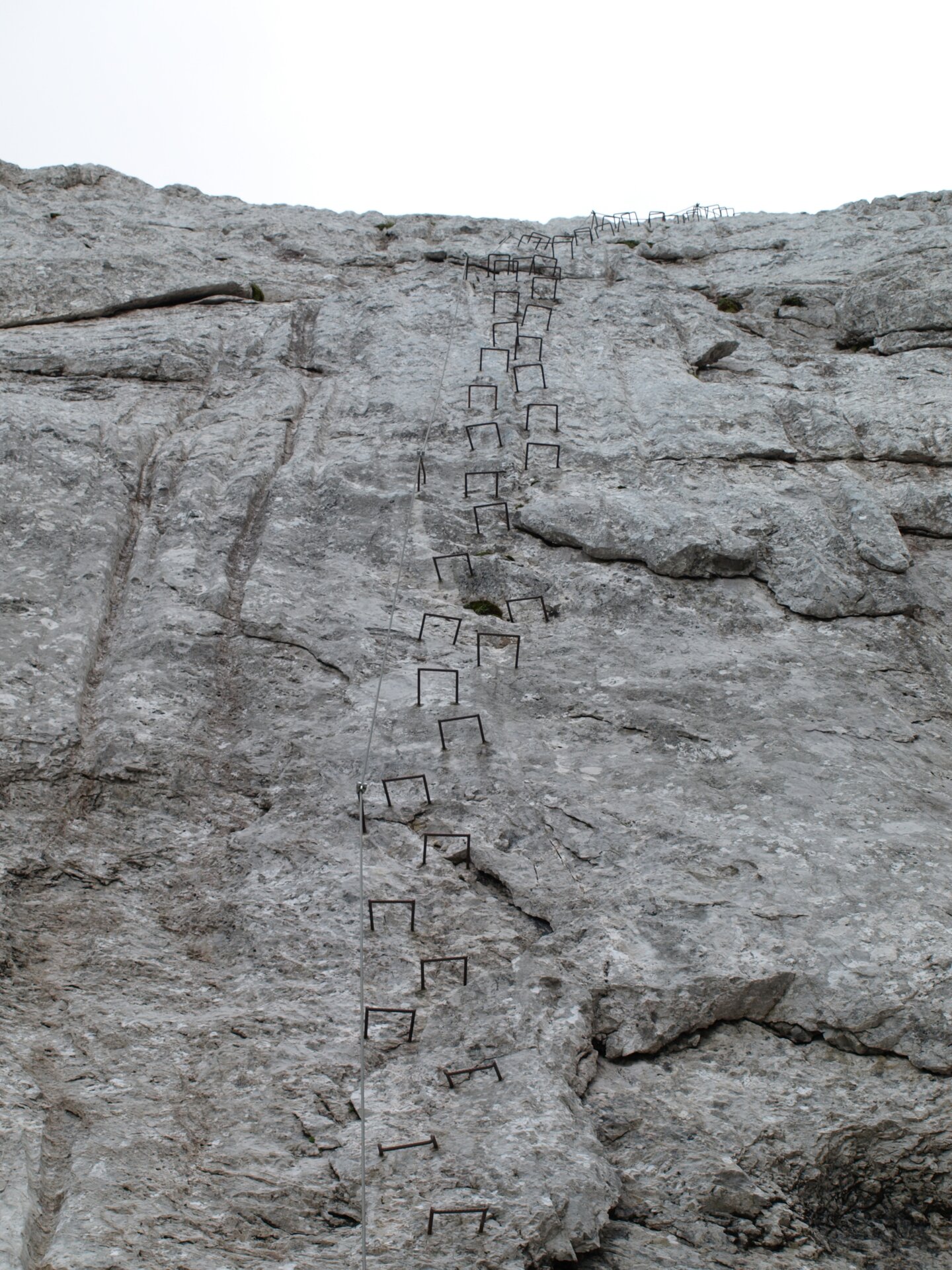
Through the Blodigrinne, you’ll ascend over steep, mostly solid, and grippy limestone slabs. The secured climbing sections are repeatedly interspersed with alpine trail sections. From the Blodigsattel, the route continues over the shoulder of the Drusenfluh toward the summit.

Just below the summit, there is an unsecured climbing section approximately 40 meters long with a difficulty rating of II. After that, you’ll reach the summit of the Drusenfluh.

Descent

The descent follows the same route. You descend via the via ferrata back to the starting point and then follow the familiar approach trail back to the Lindauer Hut.

Getting to the starting point

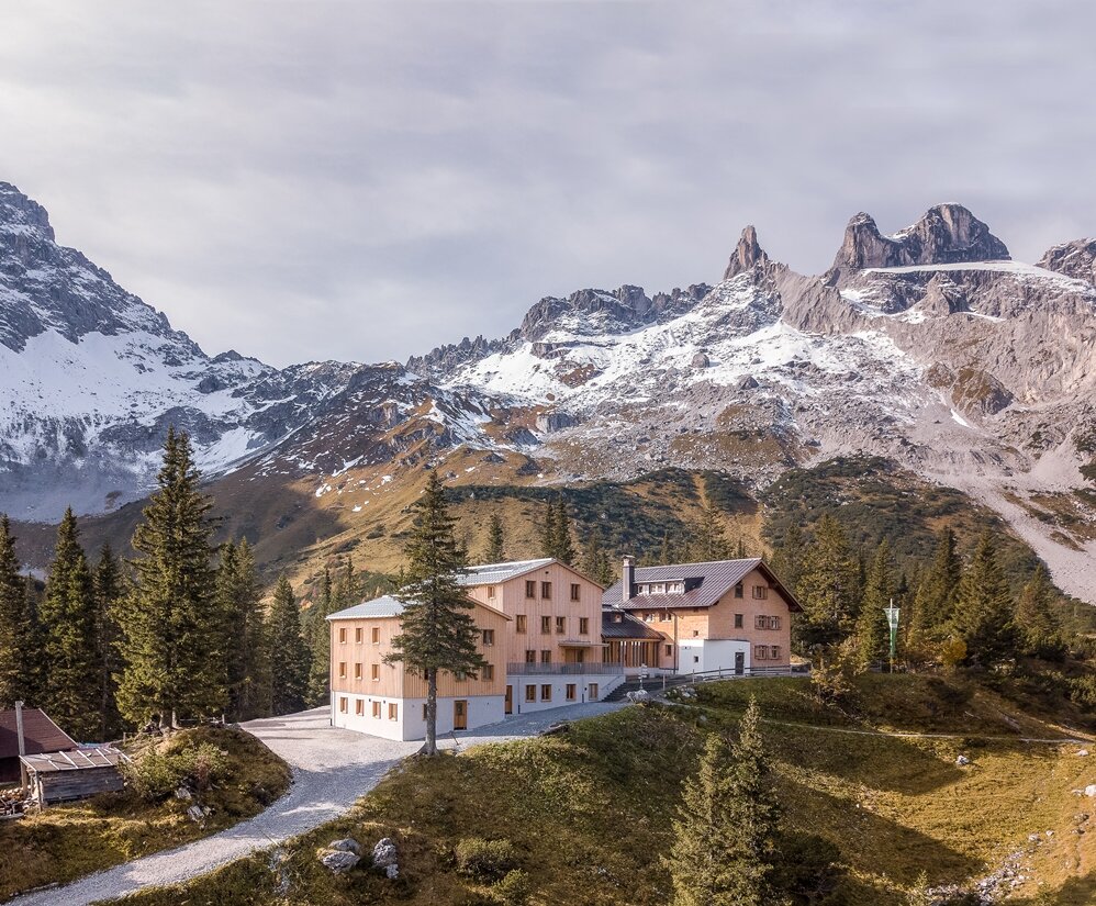
The tour starts in Latschau. First, you’ll hike through the Gauertal Valley to the Lindauer Hut. You should plan on spending about two to two and a half hours on this first section. At the hut, you can refuel before the alpine part of the tour begins.

By public transportation:

The Montafon regional bus and the Montafonerbahn provide convenient and flexible travel throughout the valley. Trains and buses run regularly between the towns, every half hour or every hour depending on the route. You can find the right connection here. Bus stop at the start/end of this tour: Latschau Golmerbahn

By car:

Take the A14 to the Bludenz/Montafon exit, then follow the Montafonerstraße L188 to Tschagguns and continue on to Latschau to the Latschau hiking parking lot (fee applies).

Equipment

This via ferrata is inspected regularly but does not have an official opening or closing status. The listed season is provided solely as a guide.

You undertake this climb at your own risk and on your own responsibility. Please check the weather, current conditions, snow conditions, and difficulty level before every climb. Especially during the transitional seasons, such as spring and fall, snow, ice, wet conditions, or sudden weather changes can make the climb significantly more difficult or even impossible.

Realistically assess your experience, surefootedness, ability to handle heights, and physical fitness. Complete, standard-compliant via ferrata equipment is absolutely essential. This includes a hip belt, via ferrata set, helmet, and gloves. Equally important are sturdy, ankle-high hiking boots with good traction.

Your backpack should also include plenty of food, sun and rain protection, and a first-aid kit.

In the Montafon, you can rent high-quality via ferrata equipment at select sports shops. Please check in advance regarding availability, sizes, and reservation options.

Tips

A route for via ferrata climbers with alpine experience!

The route is very treacherous in snowy conditions and where old snow remains. As long as old snow still covers the rock ledges and slabs on the north face above the Blodigrinne, taking the easier right-hand variant is strongly discouraged.

The tour becomes a bit less strenuous if you plan to spend the night at the Lindauer Hütte. This way, you can split the long approach over two days and start the alpine section of the mountain tour well-rested the next morning.

Sicherheitstipps für Wandern in Vorarlberg

EN NOTRUF:

EN 140 - Alpine Notfälle österreichweit 

EN 144 - Alpine Notfälle Vorarlberg 

EN 112 - Euro-Notruf (funktioniert mit jedem Handy/Netz) 

Properties
Difficulty Moderate
Start Lindauer Hütte at 1,744 m
Finish Lindauer Hütte at 1,744 m
Elevation profile
Best months
Jan
Feb
Mar
Apr
May
Jun
Jul
Aug
Sep
Oct
Nov
Dec