energie​.​wege ​-​ Route 2: Partenen ​-​ Tafamunt ​-​ Wiegensee ​-​ Verbellaalpe ​-​ Kopssee ​-​ Alpinarium Galtür

Moderate
Hiking
05:49 h duration
15,5 km Length in km
1944 m Highest point
1037 m Lowest point
1028 m gain Ascent
487 m gain Descent
Stamina
Difficulty
Adventure
Scenery

Tour description

Tafamunt mountain station (1550 m) - Wiegensee (1940 m) - Verbellaalpe - Zeinisjochhaus - Kops (reservoir, 1822 m) - Alpinarium Galtür

The energie.wege designed by Illwerke are a "walkable exhibition" centered around the energy.raum information center in Partenen.

In the energie.raum, the Illwerke VKW group, the use of alpine hydropower, the cultural and natural Montafon region, power plants, and electricity generation — from the beginnings to the Obervermuntwerk II project — are comprehensively presented. The energie.wege make many of these thematic areas a vivid experience.

Starting from the energie.raum in Partenen, take the energie.raum hiking map on an exploration tour: Along existing hiking routes in the inner Montafon, Silvretta, and Verwall regions, various information stations have been installed. Illustrated boards provide interesting details about specific power plants or point out sights.

Individual routes and circular route

The energie.wege are interconnected and can be flexibly combined. The energie.wege experience becomes more interesting and diverse when routes 1-3 are explored individually on different days. This way, you can spend more time on sights and excursions.

Detailed information about the energie.wege is contained in the energie.wege panoramic hiking map. This can be obtained at the tourist offices of Gaschurn and Partenen as well as at the valley stations of the Tafamunt and Vermunt railways and in the energie.raum in Partenen.

Route 2:
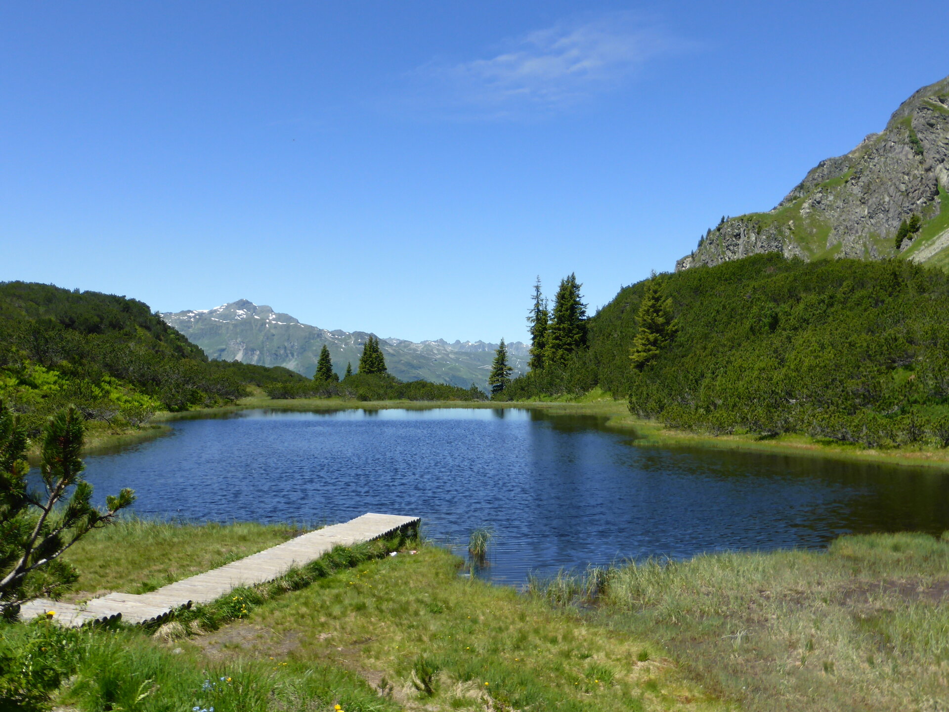
The path from Alpe Tafamunt to Verbellaalpe leads through the Natura 2000 Verwall area. Around the Wiegensee, there is a special moor landscape where the silting up of a mountain lake by tussock grass can be observed. Kops reservoir with arch dam. Picturesque lake, wonderful view of the peaks and glaciers of the Silvretta.

Info stations:
- at Tafamunt (mountain station Tafamuntbahn)
- in the area of Alpe Verbella (alpine building)
- at Kopssee
- at Alpinarium Galtür (Tel. +43 5443 20000, info@alpinarium.at)

Here you will also find a short video about Wiegensee:

https://www.youtube.com/watch?v=n7NUtvW9pLg&feature=youtu.be

Approach

Drive on the A14 to the Bludenz/Montafon exit and continue on Montafonerstraße L188 to Partenen.

Public transport

Just leave your car parked

The regional buses operate throughout Montafon. The main lines run every half hour from Schruns station.

Bus stop at the start/finish of the route: Partenen mountain railways / line 650

Timetable: www.vmobil.at

Arrival by train to Montafon

From Bludenz station the Montafon railway runs hourly (sometimes every half hour). There are also direct connections from Lindau (D) and from Bregenz

Timetable: www.oebb.at

Parking

Parking lot Tafamuntbahn Partenen

Directions

Starting from the energie.raum in Partenen to the Tafamuntbahn. Ascent with the cable car to the mountain station Tafamunt with info station: "History of the Illwerke transport routes and cable cars." Climb through the forest and through a beautiful raised bog landscape continues to the Wiegensee. The hiking trail leads you further into the Verbellatal to Verbellaalpe with info station: "Pressure tunnel Kopswerk I and II." Easy descent to Kops to Kopssee at Zeinisjoch with info station: "Kops dam." Return via Ganifer to Partenen or continue the route to Galtür in the Paznaun (Tyrol). Possibility to visit the documentation center "Alpinarium" in Galtür - digital information via info terminal - back over the Silvretta-Bielerhöhe to Partenen. Further travel or return with the bus - bus connections: Kopssee - Galtür and/or Galtür - Silvretta-Bielerhöhe - Partenen.

You can get information about bus connections at the Montafon tourist offices. Scenic road between Partenen and Galtür/Tyrol, toll required and only drivable in summer. Bus and lift use is free for holders of the Montafon-Silvretta-Card.

Equipment

good footwear, walking sticks recommended

Tips

The energie.raum is open daily all year round. Visiting the exhibition is free and barrier-free.

Destination

Galtür, Alpinarium

Starting Point

Partenen, center

Sicherheitstipps für Wandern in Vorarlberg

EN NOTRUF:

EN 140 - Alpine Notfälle österreichweit 

EN 144 - Alpine Notfälle Vorarlberg 

EN 112 - Euro-Notruf (funktioniert mit jedem Handy/Netz) 

Properties
Route type Hiking
Difficulty Moderate
Elevation profile
Best months
Jan
Feb
Mar
Apr
May
Jun
Jul
Aug
Sep
Oct
Nov
Dec