Silvretta Lake route

Moderate
Einkehrmöglichkeit
Road cycling · Refreshment stops
04:22 h duration
64,3 km Länge
2036 m Höchster Punkt
675 m Tiefster Punkt
1634 hm Aufstieg
1634 hm Abstieg
Kondition
Schwierigkeit
Erlebnis
Landschaft

Tourbeschreibung

Aktivpark Montafon - St. Gallenkirch - Gortipohl - Gaschurn - Partenen - Silvretta High Alpine Road - Silvretta Bielerhöhe (Silvretta Lake) - Silvretta High Alpine Road - Partenen Gaschurn - Gortipohl - St. Gallenkirch - Aktivpark Montafon
Approach

Coming from Bludenz, take the Bludenz/Montafon motorway exit and follow the L188 into Montafon to Schruns-Tschagguns. At the Rätikon junction continue straight towards St. Gallenkirch and then follow the signs to Aktivpark Montafon. www.maps.google.com

Public transport

Just leave your car standing

The regional buses of the Montafonerbahn operate throughout the Montafon. The main lines run hourly from Schruns station.

From Schruns station you can reach the Aktivpark Montafon by bus line 2a or 2b. The stop is: "Sportplatz/Aktivpark".

For the return trip:

You can get back to Schruns also by bus lines 2a or 2b.

mbs Bus timetables

Arrival by train

From Bludenz station the Montafonerbahn runs hourly (partly every half hour). There are also direct connections from Lindau (D) and from Bregenz.

mbs Train timetables

Parking

Free parking is available at the Aktivpark Montafon in Schruns-Tschagguns.

Directions

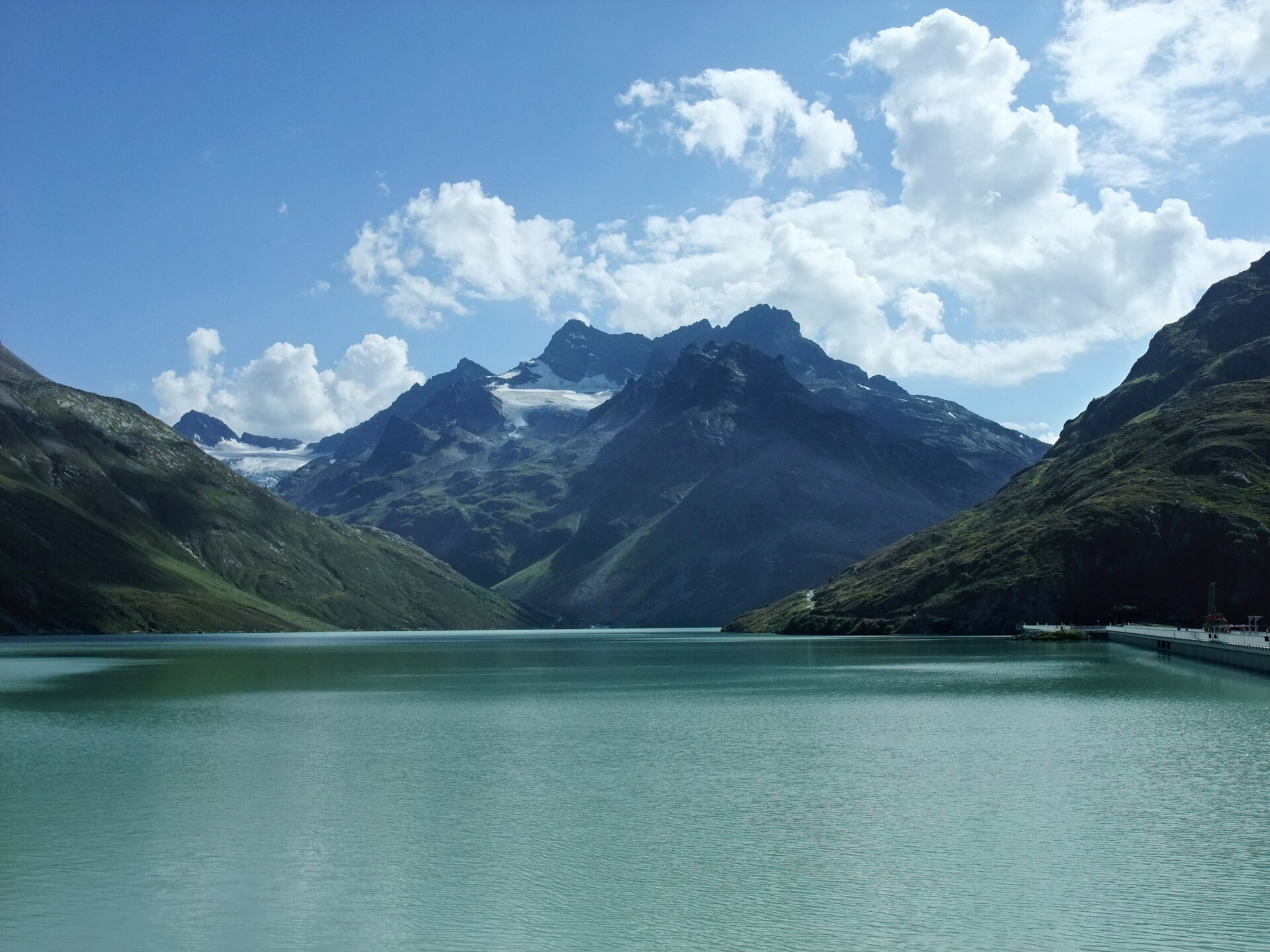
The route starts at Aktivpark Montafon and leads up the Montafon road valleywards. You cycle through the towns of St. Gallenkirch, Gortipohl, Gaschurn to Partenen. At the end of Partenen you reach the toll station of the Silvretta High Alpine Road. A popular excursion destination for everyone. In hairpin bends and 36 curves you gain altitude from around 1,000 up to 2,032 meters. You continue via the Vermuntsee to Silvretta Lake at Silvretta Bielerhöhe. An impressive panorama with the embedded Silvretta Lake lies at your feet. The highest mountain in Vorarlberg, Piz Buin with its 3,312 meters, towers ahead. There are several three-thousanders here. There are some places to stop for food and drink. Refreshed and energized you can then start the fast descent. You return to the starting point via the same way.

Equipment

Emergency equipment (spare tube, tools, pump) is strongly recommended.

Destination

Aktivpark Montafon, Schruns-Tschagguns

Starting Point

Aktivpark Montafon, Schruns-Tschagguns

Sicherheitstipps für Rad in Vorarlberg

NOTRUF:

140 - Alpine Notfälle österreichweit 

144 - Alpine Notfälle Vorarlberg 

112 - Euro-Notruf (funktioniert mit jedem Handy/Netz) 

Eigenschaften
Routentyp Road cycling, Refreshment stops
Schwierigkeit Moderate
Höhenprofil
Beste Jahreszeit
Jan
Feb
Mär
Apr
Mai
Jun
Jul
Aug
Sep
Okt
Nov
Dez