From Silvretta​-​Bielerhöhe to Vallüla

Difficult
Mountaineering · Partenen - Bielerhöhe
05:00 h duration
8,96 km Length in km
2813 m Highest point
2035 m Lowest point
800 m gain Ascent
800 m gain Descent
Stamina
Skill
Difficulty
Adventure
Scenery

Tour description

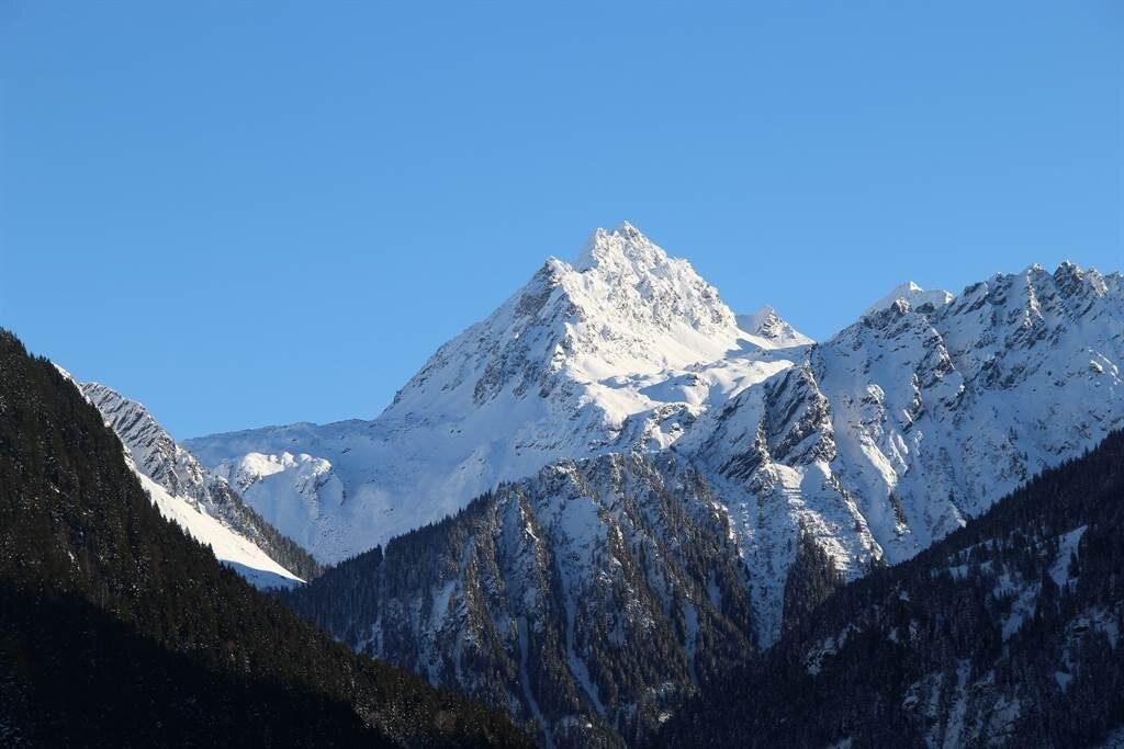
A challenging alpine mountain hike from the Silvretta-Bielerhöhe via the Maißboden to the 2,813-meter-high Vallüla, featuring rock-climbing sections and sweeping views of the Silvretta.

Starting from the Silvretta-Bielerhöhe, this challenging mountain hike takes you from Lake Silvretta up into increasingly rugged, alpine terrain. Via the Maißboden and the steep Halberstätterweg trail, you’ll reach the saddle between the Kleine and Große Vallüla before a narrow trail with some rock-climbing sections leads to the 2,813-meter summit. A tour for experienced mountaineers who, in addition to physical fitness, must also have sure-footedness, a head for heights, and the ability to move safely on rocky terrain.

Starting Point - Directions - End Point

Starting Point
Silvretta-Bielerhöhe

Directions

The hike begins at Silvretta-Bielerhöhe. At the chapel, follow the trail northeast, initially approaching the base of the Vallüla.

Soon, the trail begins to climb steeply. Crossing steep slopes, you’ll reach the green high plateau of the Maißboden. The contrast between the open plateau and the towering rock faces above offers a foretaste of the alpine character of the rest of the trail.

At the trail sign on the Maißboden, keep to the right. Follow the steep Halberstätterweg northward up to a saddle between the Kleine and Große Vallüla.

From here on, the character of the hike changes significantly. A narrow trail leads through rocky terrain toward the summit. Along the way, you’ll encounter climbing sections rated I to II in difficulty.

Extra caution is required when crossing the gullies. Even in summer, old snowfields may still remain here, which can make the ascent even more difficult.

Climbing over the rocky summit structure, you’ll finally reach the Vallüla at 2,813 meters. At the highest point, the view opens up over the Silvretta-Bielerhöhe and Lake Silvretta, as well as far into the surrounding high-mountain landscape.

The descent follows the same route as the ascent. Via the saddle, the Halberstätterweg, and the Maißboden, you’ll return to the Silvretta-Bielerhöhe.

Endpoint
, Silvretta-Bielerhöhe

Getting to the starting point

The tour starts at the Silvretta-Bielerhöhe.
The Silvretta High Alpine Road is expected to remain closed until summer 2030.
Therefore, in the summer, you cannot reachthe Bielerhöhe from the Montafon by car or public transportation via the High Alpine Road; instead, you’ll need to take the Vermuntbahn from Partenen and then transfer to the tunnel bus.

You can find more information here.

By Public Transportation

With the Montafon regional bus and the Montafonerbahn, you can get around the valley comfortably and flexibly. The train and bus connect the towns regularly, every half hour or hourly depending on the route. You can find suitable connections in the cleVVVer mobil schedule app. The nearest stop is “Partenen Bergbahnen Talstation.” From there, you can reach the Vermuntbahn valley station in just a few minutes on foot.

By car

By car, drive to Partenen to the valley stations of the Vermuntbahn or Tafamuntbahn. The two valley stations are just a few minutes’ walk apart. Parking is available near the valley stations. Since parking conditions may change due to construction work, please follow the current on-site signage and check in advance for available parking spaces.

Important Information

The Vallüla is not a typical hike, but rather a challenging alpine mountain trek. In the upper section, you’ll encounter narrow trails and climbing sections rated I to II in difficulty.

You’ll need very sure-footedness, a head for heights, alpine experience, and confidence on easy climbing terrain. Sturdy, ankle-high hiking boots are essential.

Extra caution is required in the gullies below the summit. Even in summer, persistent patches of old snow may remain there. Depending on conditions, crossing these areas may require additional alpine equipment and appropriate experience.

In wet conditions, poor visibility, risk of thunderstorms, or unsafe conditions, you should refrain from undertaking this tour. Be sure to check the current weather, snow, and trail conditions before setting out.

For this tour, it is recommended that you be accompanied by a state-certified mountain guide.

Also, be sure to check the operating hours of the Tunnelbus and Vermuntbahn for your return trip.

Tips

Don’t be fooled by the distance: Just under nine kilometers may seem manageable at first. However, what really matters on this tour isn’t the distance, but the steep terrain and the climbing sections in the upper part.

Maißboden: The green high plateau offers a striking contrast to the rocky summit of the Vallüla. It’s worth taking a brief moment here before the more technically challenging part begins.

Start early: Setting out early gives you a time buffer and reduces the risk of getting caught in afternoon thunderstorms.

Hiking with a mountain guide: If you don’t feel completely confident in off-trail or easy climbing terrain, a tour with a state-certified Montafon mountain guide is recommended.

Sicherheitstipps für Wandern in Vorarlberg

EN NOTRUF:

EN 140 - Alpine Notfälle österreichweit 

EN 144 - Alpine Notfälle Vorarlberg 

EN 112 - Euro-Notruf (funktioniert mit jedem Handy/Netz) 

Properties
Route type Mountaineering
Difficulty Difficult
Start Silvretta-Bielerhöhe
Finish Silvretta-Bielerhöhe
Elevation profile
Best months
Jan
Feb
Mar
Apr
May
Jun
Jul
Aug
Sep
Oct
Nov
Dec