Silvretta Hut Route "Medium"


Tour description
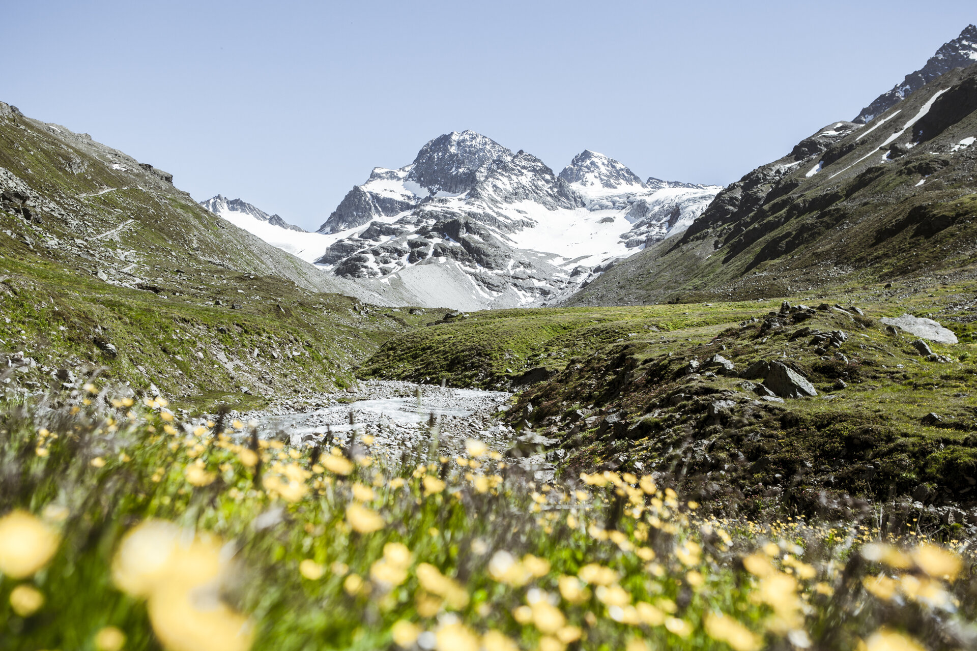
An impressive hut route in the majestic Silvretta in Montafon.
A route for mountain enthusiasts who appreciate the natural beauty of the mountains as well as well-maintained, regional cuisine. The hiking trails lead through the Silvretta past glaciers and the highest mountains of Vorarlberg. The impressive high alpine character of the Silvretta is palpable and experienceable on every step and shapes this stage hike.
Approach
Coming from Bludenz take the Bludenz/Montafon motorway exit and follow the L188 into Montafon up to Vermuntsee. (There are toll fees for the Silvretta high alpine road).
Public transport
Just leave your car standing
The regional buses of Montafonerbahn operate throughout Montafon. The main lines run hourly from Schruns station.
Arrival by bus
From Schruns station, you reach Silvretta-Bielerhöhe with bus line 85. The stop is: "Vermuntsee."
Arrival by train
From Bludenz station, the Montafonerbahn runs hourly (sometimes half-hourly). There are also direct connections from Lindau (D) or from Bregenz.
Directions
Stage 1: Vermuntsee to Saarbrücker Hut
From the Vermuntsee parking lot, follow the signpost uphill to the Saarbrücker Hut along a wide gravel path.
Walking time approx. 3:00 hrs // approx. 5.8 km // ascent 784 m, descent 1 m
Stage 2: Saarbrücker Hut to Madlenerhaus
For the first 1.5 kilometers, you go uphill on the same path you came from. Now turn right and follow this hiking trail across the Tschiffernella area until you reach the Madlenerhaus. The Madlenerhaus is located directly below the dam of the Silvretta Lake.
Walking time approx. 2:30 hrs // approx. 6.5 km // ascent 51 m, descent 604 m
Stage 3: Madlenerhaus to Wiesbadener Hut
From the Madlenerhaus, you hike up to the Silvretta Lake. The hike starts at the Silvretta Lake and leads left over the dam to the junction into the Bieltal. The lively Bieltalbach takes on the first elevation meters. As a larger lake, the Radsee lies to the right of the path on a height, embedded in green meadows. Now you have to cross rock and scree fields. Higher up the path becomes wetter as smaller lakes are located in the terrain. The Radsattel is reached. The view is magnificent. Grey-green and rust-red rugged rock ridges rise from green mats. Behind them shine the white firn fields and impressive glaciers. The descent to the Wiesbadener Hut starts a bit steeply and then zig-zags downhill.
Walking time approx. 4:00 hrs // approx. 8.7 km // ascent 746 m, descent 286 m
Stage 4: Wiesbadener Hut to Silvretta-Bielerhöhe
At the Wiesbadener Hut you now go downhill back to the Silvretta Lake and follow the west shore back to the Madlenerhaus. From here you then return to the Vermunt reservoir where you parked your car.
If you have no reserves left for the last few meters downhill, you can also take the public bus from Silvretta Lake down to Vermuntsee.
Walking time approx. 4:25 hrs // approx. 12 km // ascent 61 m, descent 1,758 m
Equipment
Good, ankle-high hiking boots with good grip, sufficient food and drinks to take, hiking poles recommended.
Tips
Due to high demand at the huts, we recommend reserving sleeping places directly at the huts early enough.
Destination
Silvretta-Bielerhöhe
Starting Point
Vermuntsee
Sicherheitstipps für Wandern in Vorarlberg
EN NOTRUF:
EN 140 - Alpine Notfälle österreichweit
EN 144 - Alpine Notfälle Vorarlberg
EN 112 - Euro-Notruf (funktioniert mit jedem Handy/Netz)


